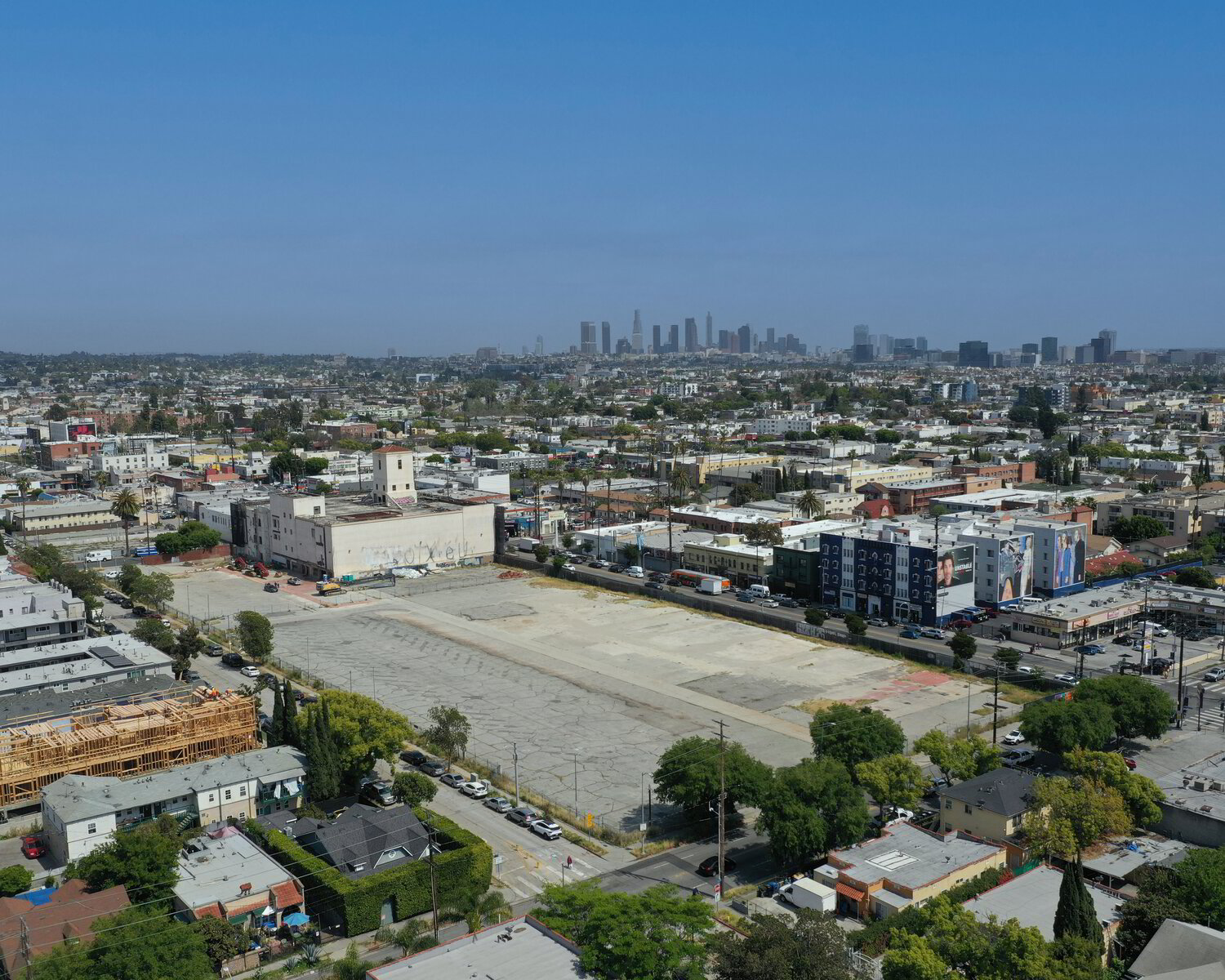
Transform Your LA Construction Projects with Aerial Intelligence
Los Angeles is one of the most active construction markets in the nation, with billions of dollars in commercial, residential, and infrastructure development underway at any time. In this competitive environment, project managers and contractors are turning to drone technology for accurate site documentation, efficient progress tracking, and data-driven decision making.
Our construction drone services help LA contractors and developers gain a clear picture of their sites—from pre-construction surveys through project completion. We deliver the accurate, timely data you need to keep projects on track and stakeholders informed.
Construction Drone Services We Provide
Orthomosaic Mapping
High-resolution, georeferenced aerial maps of your construction site. Our orthomosaics stitch together hundreds of overlapping drone images into a single, dimensionally accurate map that can be measured and analyzed. Perfect for site planning, progress documentation, and stakeholder communication.
3D Site Models
Photogrammetric 3D models generated from drone imagery provide visual context that 2D maps cannot. Explore your site virtually, share interactive models with stakeholders, and document existing conditions before construction begins. Models export to common CAD and BIM formats.
Volumetric Analysis
Calculate cut/fill volumes, stockpile quantities, and earthwork progress with drone-derived elevation data. Our volumetric reports provide accuracy that often exceeds traditional survey methods at a fraction of the time and cost. Critical for earthwork contractors, mining operations, and large grading projects.
Progress Documentation
Scheduled aerial documentation captures your project's evolution from groundbreaking to ribbon cutting. Compare progress against plans, communicate status to stakeholders, and create a visual record for dispute resolution and as-built documentation. Our recurring flight programs ensure consistent coverage throughout your project.
Why LA Contractors Choose Drone Mapping
Los Angeles construction presents unique challenges—complex hillside grading, seismic considerations, stringent building codes, and demanding schedules. Drone mapping addresses these challenges:
- Faster site surveys — Cover large sites in hours instead of days, reducing survey costs and accelerating project timelines
- Improved safety — Document hazardous areas without putting personnel at risk; reduce time on unstable slopes and active sites
- Better stakeholder communication — Visual progress reports that anyone can understand, from investors to city officials
- Accurate earthwork tracking — Know exactly how much material has been moved, placed, or remains—critical for payment applications
- Historical documentation — Timestamped aerial records prove project status at any point, valuable for disputes and claims
- Integration with existing workflows — Data exports to Procore, PlanGrid, Autodesk, and other platforms your team already uses
Los Angeles Construction Expertise
LA construction has unique characteristics that require local expertise:
Hillside Development
From the Hollywood Hills to Pacific Palisades, hillside construction dominates the LA landscape. Our pilots are experienced with the challenging terrain, steep grades, and complex grading plans common to hillside projects. Drone-derived topographic data is particularly valuable for cut/fill calculations on hillside sites.
Seismic Retrofit Projects
Los Angeles has thousands of buildings undergoing seismic retrofit. Drone documentation provides before, during, and after records of retrofit work—valuable for building department submittals and insurance documentation.
Urban Infill & High-Rise
Downtown LA and other urban cores present tight spaces and complex airspace. We're experienced with urban site documentation, coordinating flights in congested areas while maintaining FAA compliance and neighbor relations.
Our Process
1. Project Consultation
We start by understanding your project scope, deliverable requirements, and timeline. For ongoing progress documentation, we'll develop a flight schedule aligned with your project milestones. We'll also assess airspace requirements and any special permitting needs.
2. Flight Planning
Our team creates optimized flight plans based on your site dimensions, required accuracy, and deliverable types. For survey-grade accuracy, we'll coordinate placement of ground control points with your surveyor. We handle all FAA authorizations, including LAANC approvals for controlled airspace.
3. Data Capture
Flights are conducted during optimal conditions—typically early morning or overcast days to minimize shadows. We coordinate with your site superintendent to ensure safe operations. Most sites require 1-3 hours for complete coverage depending on size and complexity.
4. Processing & Delivery
Data is processed using industry-leading photogrammetry software. Standard turnaround is 2-3 business days for orthomosaics and 3-5 days for full 3D models and volumetric analysis. Rush processing available. Deliverables arrive via secure download link in your preferred formats.
Service Areas
We provide construction drone services throughout Los Angeles County:
- Downtown Los Angeles — High-rise and urban infill projects
- Hollywood & Hollywood Hills — Hillside residential and commercial
- Santa Monica & Westside — Coastal development and retrofit
- Long Beach & South Bay — Port facilities and industrial
- Pasadena & San Gabriel Valley — Commercial and institutional
- LA County-Wide — Infrastructure, utility, and transportation projects
Pricing
Construction drone mapping pricing varies based on site size, deliverables, and accuracy requirements:
Basic Aerial Documentation — Starting at $399
High-resolution aerial photos and basic orthomosaic map. Ideal for progress photos and stakeholder updates.
Standard Mapping Package — Starting at $699
Survey-grade orthomosaic, digital elevation model, and 3D point cloud. Suitable for most construction documentation needs.
Complete Site Analysis — Starting at $999
Full mapping suite plus volumetric analysis, progress comparison, and detailed reporting. For complex projects requiring comprehensive data.
Recurring Flight Programs — Custom Pricing
Scheduled weekly, bi-weekly, or monthly flights at discounted rates. Includes consistent deliverables and progress tracking dashboard.
Construction Mapping FAQs
Common questions about drone mapping for LA construction projects
What types of construction projects do you work with in Los Angeles?
We work with all scales of construction in LA—from single-family home builds to major commercial developments, infrastructure projects, and public works. Our clients include general contractors, developers, architects, civil engineers, and government agencies throughout Los Angeles County. We have particular expertise in hillside construction common to LA's topography.
How accurate are your drone mapping deliverables?
Our orthomosaic maps achieve 1-2cm/pixel ground sampling distance (GSD) using RTK-enabled drones. For projects requiring survey-grade accuracy, we work with licensed surveyors to place ground control points (GCPs), achieving accuracies within 1-2cm horizontal and 2-3cm vertical. This meets or exceeds requirements for most construction documentation purposes.
How often should we schedule progress documentation flights?
Most LA construction projects benefit from bi-weekly or monthly documentation flights. High-rise and fast-moving projects often need weekly coverage. We offer scheduled recurring flight programs at discounted rates, ensuring consistent documentation throughout your project timeline. We can also respond to milestone events within 24-48 hours.
Can you fly drones near active construction in LA?
Yes, with proper planning. We coordinate with your site superintendent to ensure safe operations. We typically fly during low-activity periods (early morning or after work hours) or coordinate with your team to clear specific areas. All flights follow FAA regulations and OSHA guidelines for construction site aerial operations.
What deliverables do you provide for construction projects?
Standard deliverables include: high-resolution orthomosaic maps, digital elevation models (DEM), 3D point clouds, volumetric calculations, progress comparison reports, and annotated aerial photos. We can export in formats compatible with BIM software, CAD systems, and project management platforms like Procore, PlanGrid, and Autodesk Construction Cloud.
How do you handle LA's complex airspace for construction sites?
Many LA construction sites fall within controlled airspace near airports. We maintain real-time LAANC authorization capability and have established relationships with local air traffic control facilities. For sites requiring extended operations, we can secure longer-term airspace authorizations through proper FAA channels.
Ready to Modernize Your Site Documentation?
Get accurate, timely drone data for your Los Angeles construction project. Contact us for a custom proposal.